Docente a contratto
Insegnamenti in altri corsi di studio
Ingegneria Civile - IASA
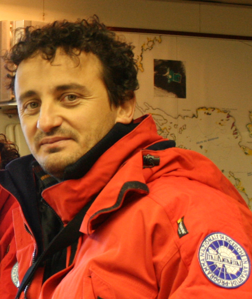
Profilo biografico
Marco Dubbini è Professore Associato in Geomatica presso l’Università di Bologna e Professore a Contratto presso l’Università di San Marino. Dal 2008 al 2021 è stato Ricercatore Tecnico e Professore a Contratto presso la sezione di Geografia dell’Università di Bologna. Ha ricevuto nel 2001 il Dottorato di Ricerca in Scienze Geodetiche e Topografiche dall’Università di Bologna, dove ha anche conseguito la Laurea di vecchio ordinamento in Ingegneria Civile sez. Trasporti nel 1998. La sua ricerca e il suo lavoro riguardano il campo della Geomatica (Geodesia, Topografia, Fotogrammetria, Remote an Proximal Sensing) in applicazioni riguardanti il
Principali pubblicazioni
Ultime Pubblicazioni:
74 Cortesi, I.; Masiero, A.; De Giglio, M.; Tucci, G.; Dubbini, M. (2021), RANDOM FOREST-BASED RIVER PLASTIC DETECTION WITH A HANDHELD MULTISPECTRAL CAMERA. The International Archives of the Photogrammetry, Remote Sensing and Spatial Information Sciences, VOL. XLIII-B1-2021, 9-14, doi: 10.5194/isprs-archives-XLIII-B1-2021-9-2021 [Contributo in Atti di convegno]
75 Rossi Paolo; Ponti Massimo; Righi Sara; Castagnetti Cristina; Simonini Roberto; Mancini Francesco; Agrafiotis Panagiotis; Bassani Leonardo; Bruno Fabio; Cerrano Carlo; Cignoni Paolo; Corsini Massimiliano; Drap Pierre; Dubbini Marco; Garrabou Joaquim; Gori Andrea; Gracias Nuno; Ledoux Jean-Baptiste; Linares Cristina; Mantas Torcuato Pulido; Menna Fabio; Nocerino Erica; Palma Marco; Pavoni Gaia; Ridolfi Alessandro; Rossi Sergio; Skarlatos Dimitrios; Treibitz Tali; Turicchia Eva; Yuval Matan; Capra Alessandro (2021), Underwater technologies and methods for the investigation of marine animal forest 3D-structural complexity. FRONTIERS IN MARINE SCIENCE, vol. 8, p. 1-9, ISSN: 2296-7745, doi: 10.3389/fmars.2021.591292 [Articolo]
76 Dubbini, M.; Palumbo, N.; De Giglio, M.; Zucca, F.; Barbarella, M.; Tornato, A. (2022) Sentinel-2 Data and Unmanned Aerial System Products to Support Crop and Bare Soil Monitoring: Methodology Based on a Statistical Comparison between Remote Sensing Data with Identical Spectral Bands. Remote Sens. 2022, 14, 1028. https://doi.org/10.3390/ rs14041028 [Articolo]
77 Felice, E., De Giglio, M., Dubbini, M., Vignoli, V. and Minelli, A. (2022). Historic gardens restoration – preliminary outcomes from a synergistic application of visual assessment and geomatic techniques to optimize the management of arboreal heritages. Acta Hortic. 1345, 115-122, DOI: https://doi.org/10.17660/ActaHortic.2022.1345.15 [Contributo in Atti di convegno]
78 Dubbini, M., De Giglio M., Salvatori C., (2022). SAR and Multispectral Data Contribution to the Monitoring of Wetland Ecosystems Vulnerable to Climate Change. In: Borgogno-Mondino, E., Zamperlin, P. (eds) Geomatics for Green and Digital Transition. ASITA 2022. Communications in Computer and Information Science, vol 1651. Springer, Cham. https://doi.org/10.1007/978-3-031-17439-1_30 [Contributo in Atti di convegno]
79 Candotti, A.; De Giglio, M.; Dubbini, M.; Tomelleri, E. (2022) A Sentinel-2 Based Multi-Temporal Monitoring Framework for Wind and Bark Beetle Detection and Damage Mapping. Remote Sens. 2022, 14, 6105. https://doi.org/10.3390/rs1423610 [Articolo]
80 Vittuari, L.; Zanutta, A.; Lugli, A.; Martelli, L.; Dubbini, M. (2023) Sea Tide Influence on Ice Flow of David Drygalski’s Ice Tongue Inferred from Geodetic GNSS Observations and SAR Offset Tracking Analysis. Remote Sens. 2023, 15, 2037. https://doi.org/10.3390/rs15082037 [Articolo]
81 Brunelli, B., De Giglio, M., Magnani, Dubbini, M., (2023) Surface soil moisture estimate from Sentinel-1 and Sentinel-2 data in agricultural fields in areas of high vulnerability to climate variations: the Marche region (Italy) case study. Environ Dev Sustain (2023). https://doi.org/10.1007/s10668-023-03635-w [Articolo]
82 Tornato, A., Ricolfi, S., Pirola, A., Belluzzo, M., Zanni Bertelli, V., Sapio, S., Dubbini, M., Filipponi, F., Alessandrini, C., (2023) A GIS-Based Approach for Manure-Spreading Monitoring within the Digital Agricultural Framework. In The 3rd International Electronic Conference on Agronomy, Conference date 15-30 october 2023 DOI: https://dx.doi.org/10.3390/IECAG2023-15804 [Contributo in Atti di convegno]
83 Dubbini M, Belluzzo M, Zanni Bertelli V, Pirola A, Tornato A, Alessandrini C. The Identification of Manure Spreading on Bare Soil through the Development of Multispectral Indices from Sentinel-2 Data: The Emilia-Romagna Region (Italy) Case Study. Sensors. 2024; 24(14):4687. https://doi.org/10.3390/s24144687
Interessi di ricerca
Nell’ambito della ricerca nel setore della geomatica mi sono sempre occupato di geodesia, topografia e fotogrammetria, laser scanner, remote sensing, rappresentazione, gestione, e analisi statistiche dei dati in ambiente GIS.
Dal 2003 faccio parte del gruppo di ricerca del Programma Nazionale di Ricerca in Antartide ed ho partecipato a 8 spedizioni scientifiche nel continente antartico per la misurazione e lo studio dei movimenti crostali mediante sistemi satellitari, nella Terra Vittoria Settentrionale.
Mi sono anche sempre occupato dello studio e dell’integrazione dei sistemi di acquisizione dati sia terrestri che aerei (geodetici, topografici, fotogrammetrici, laser scanner, multispettrali, iperspettrali) ed all’ottimizzazione delle tecniche di processamento dei dati per la descrizione, caratterizzazione e monitoraggio del territorio, delle strutture, delle colture agricole, arboree e forestali e per la salvaguardia dei beni culturali.